Ed Nisley's Blog: Shop notes, electronics, firmware, machinery, 3D printing, laser cuttery, and curiosities. Contents: 100% human thinking, 0% AI slop.
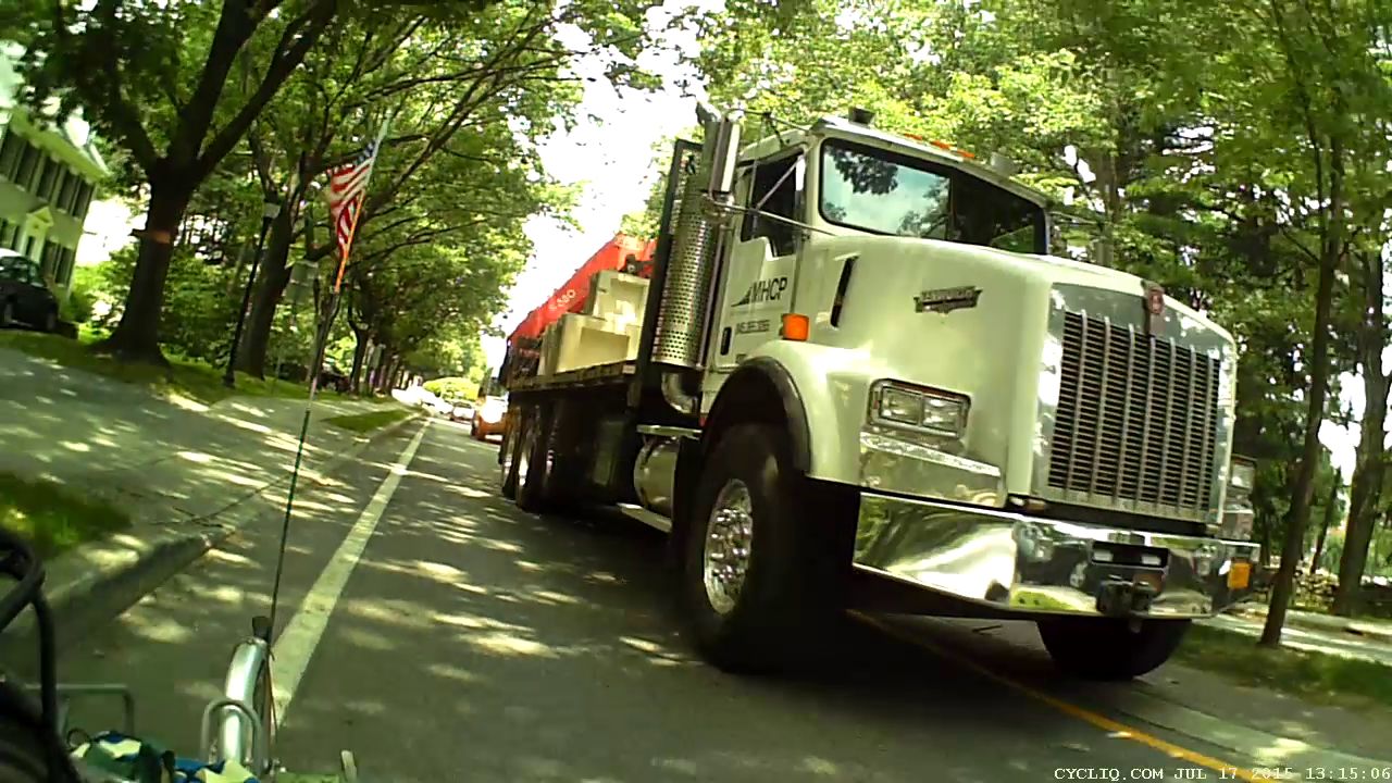
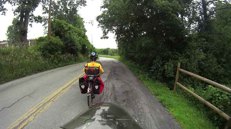
Commercial truck drivers generally know what they’re doing, what their vehicle can do, and drive both responsibly and carefully. This driver waited patiently until an oncoming car passed beside us, then eased around us as we pedaled slowly up the hill from Rt 376 on Maloney Rd:
Maloney Rd 2015-07-24 – Truck 1
As usual, we were as far to the right as we could get:
Maloney Rd 2015-07-24 – Truck 2
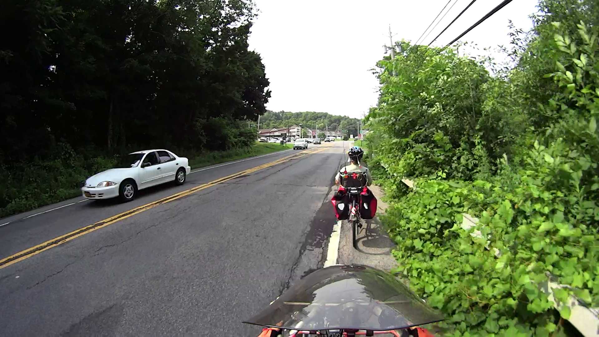
Those parallel bar drain grates along the side of the road just add a bit more tension when the timing doesn’t work out this nicely:
Maloney Rd 2015-07-24 – Truck 3
Other than that, it was a fine day for a ride.
Shortly after sending these pictures to the Town of Wappingers, this happened:
Maloney Rd 2015-08-02 – Patched
A series of long, smooth patches over the worst parts of the uphill grade definitely improved the situation. With a fair wind and some money, they’ll repave the entire section from Rt 376 to well beyond the Dutchess Rail Trail during next year’s maintenance season.
Notice the street lamp in view directly above the cab? Keep that in mind.
In order to give us that much clearance, he had to put the left wheels up on the median:
Raymond Ave – 2015-07-17 – Truck Clearance 2
That’s exactly what the NYSDOT engineer who designed Raymond Avenue explained to me drivers should do. Driving on the median is the intent of the Raymond Avenue layout.
FWIW, the “brick paver” median surface is actually stamped asphalt (or some thermoplastic material) painted brick red. It has marginal durability; the same material in the rotary islands began disintegrating after a few months, has accumulated many non-textured patches, and was obviously not intended to support routine travel.
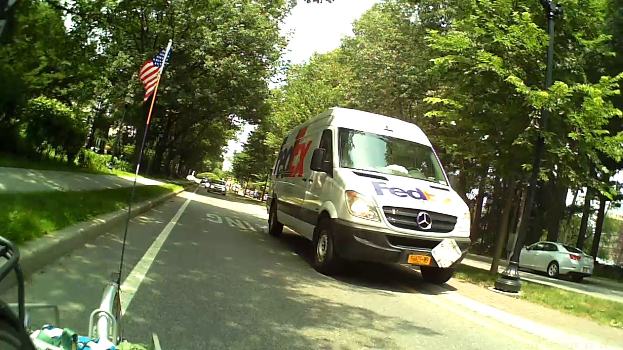
After that truck passed, the FedEx driver also gave us plenty of clearance, also with left wheels on the median:
Raymond Ave – 2015-07-17 – Truck Clearance 3
Notice the minimal clearance between that lamp post and the protruding driver-side mirror? You’re supposed to drive on the median to avoid cyclists, while simultaneously not colliding with a zero-clearance black lamp post.
Those lamp posts replaced the original bollards bracketing the crosswalk (just ahead of Mary in the first picture). Those bollards stood directly in the pseudo-brick area on both sides of the travel lane, with zero clearance from the inclined curb and roughly in line with those truck headlights: anyone driving up on the median at the crossing to avoid a cyclist would mow down a nonreflective black bollard.
And, indeed, mowed down they were.
A few years ago, NYSDOT removed the bollards from the “pedestrian refuges” (that’s their term for the crosswalk median area) and repositioned the remainder in the center of the median, presumably to protect them from drivers.
Janet Drive is across Rt 44 from the patch palimpsest I’ve already described. It serves as an entrance to two strip malls and the Canterbury Gardens apartment complex and, oddly enough, turns out to be a private road owned by Canterbury.
A huge pothole is consuming the pavement in front of the mall entrance behind the Rhinebeck Bank branch:
Janet Dr at 708 Dutchess Turnpike entrance – 2015-07-12
The light gray patches mark smaller potholes filled with what appears to be Sackrete:
Janet Dr at 708 Dutchess Turnpike – patches – 2015-07-12
The potholes made turning from Rt 44 onto Janet a bit of a challenge, particularly with drivers trying to pass on the left during the turn. We now signal for and take the entire lane from Rt 44 to the mall entrance, although impatient drivers still roar around us, directly into oncoming traffic.
Because Janet is a private drive, it doesn’t quite qualify for the Tax Dollars Asleep tag, but it gives you the general idea. The road is not signed “Private Drive” and, at least in that section, is obviously used by the general public, so it’s not at all clear what repair standards apply.
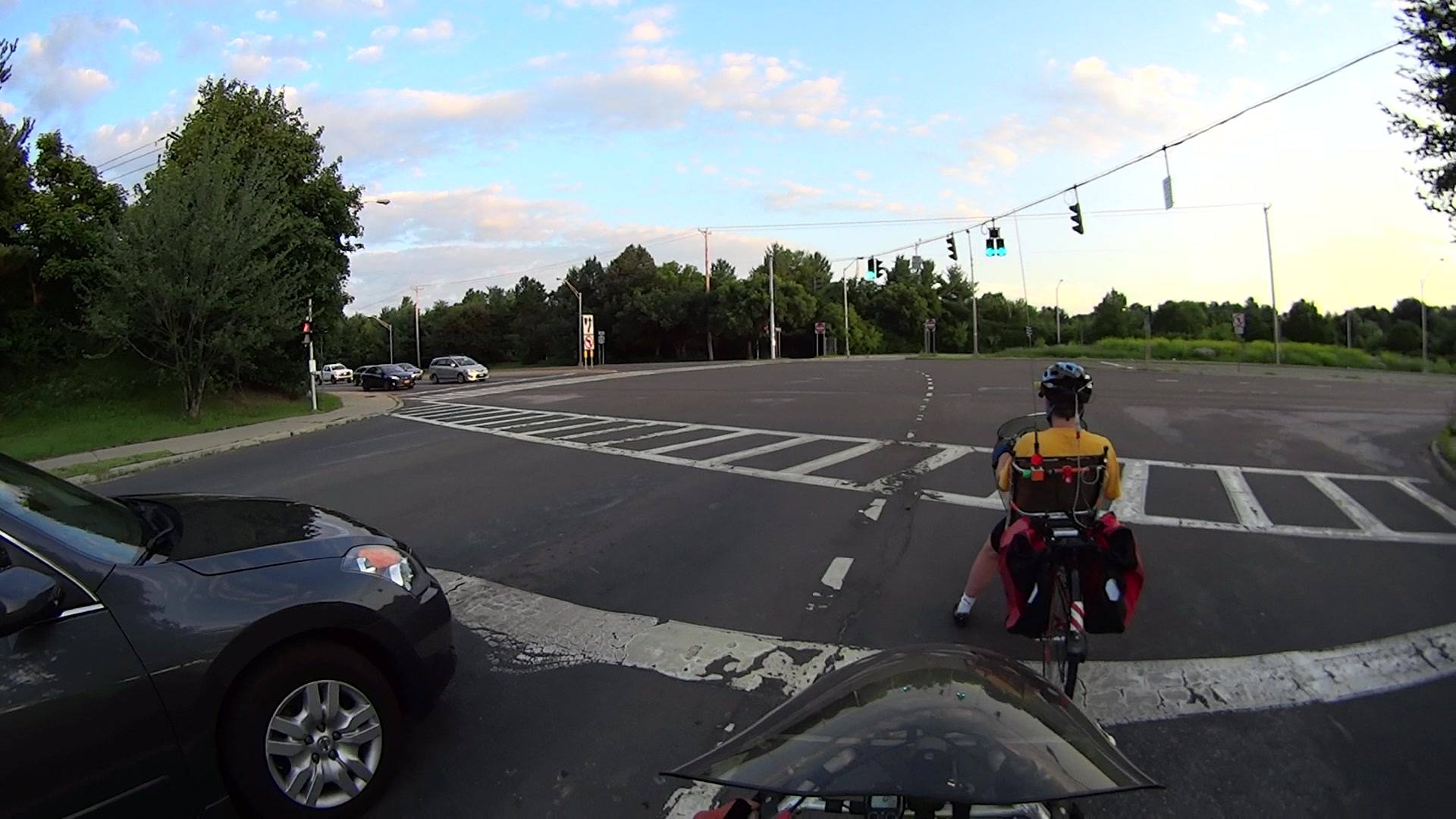
Adapted from an email to NYSDOT (hvtmc@dot.state.ny.us):
The minimum green and yellow times on the signals from Burnett Blvd to Rt 55 are too short for bicycle traffic making a left turn across six traffic lanes.
The pictures show key points from our ride on 2015-07-10, returning from the Balloon Festival in Poughkeepsie. We took the DCRT around Poughkeepsie, went through Arlington to Rt 376 at Collegeview, then took Rt 376 Red Oaks Mill.
The image sequence numbers identify frames extracted from video files. The front camera (a Sony HDR-AS30V) runs at 60 fps and the rear camera (a Cycliq Fly6) at 30 fps, so you can directly calculate the time between frames. The Fly6 timestamp is one hour ahead, for reasons I don’t quite understand.
The red signals are turning off and the greens haven’t lit up yet:
Burnett at Rt 55 Signal – Front 0196
One second later, the car and our bikes are starting to roll:
The yellow signals begin turning on seven seconds after the green:
Burnett at Rt 55 Signal – Front 0633
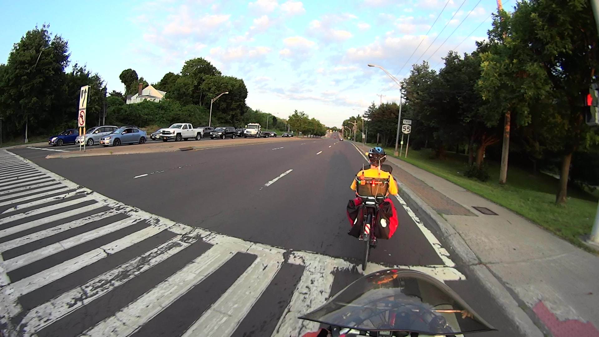
The car has reached the pedestrian ladder across Rt 55, but we’re still crossing the westbound lanes of traffic. Note that I’m lined up with the lane closest to our starting point on Burnett: this is a big intersection. We may not be the fastest riders on the road, but we’re not the slowest, either.
We’ve reached the far side of the intersection just under 16 seconds from the green:
Burnett at Rt 55 Signal – Front 1142
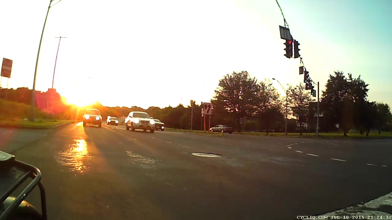
However, the opposing signals turned green while we’re still crossing the eastbound lanes of Rt 55, 15 seconds after the Burnett Blvd signals went green:
Burnett at Rt 55 Signal – Rear 0408
About 2.7 seconds later, cars have been accelerating across the intersection toward us as we reach the pedestrian ladder:
Setting the minimum Burnett green to 12 seconds, the minimum yellow to 10 seconds, and the minimum delay from Burnett green to Rt 55 green to 30 seconds would help cyclists (just barely) reach the far side of the intersection before opposing traffic starts rolling.
As a bonus, adjusting the sensor amplifiers on Burnett to respond to bicycles and marking the coil locations on the pavement in both lanes would help us through the intersection during low-traffic-volume times, as our bikes seem unable to trip the signals.
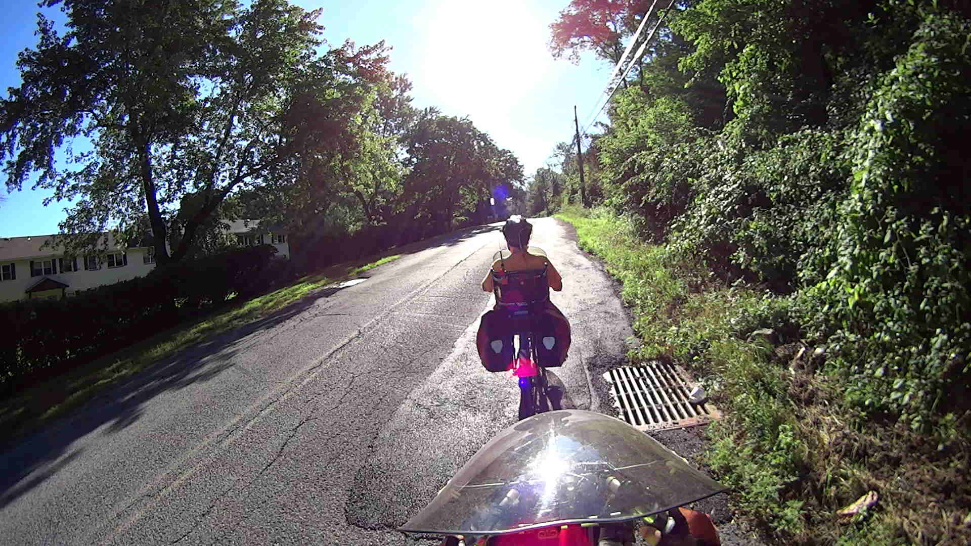
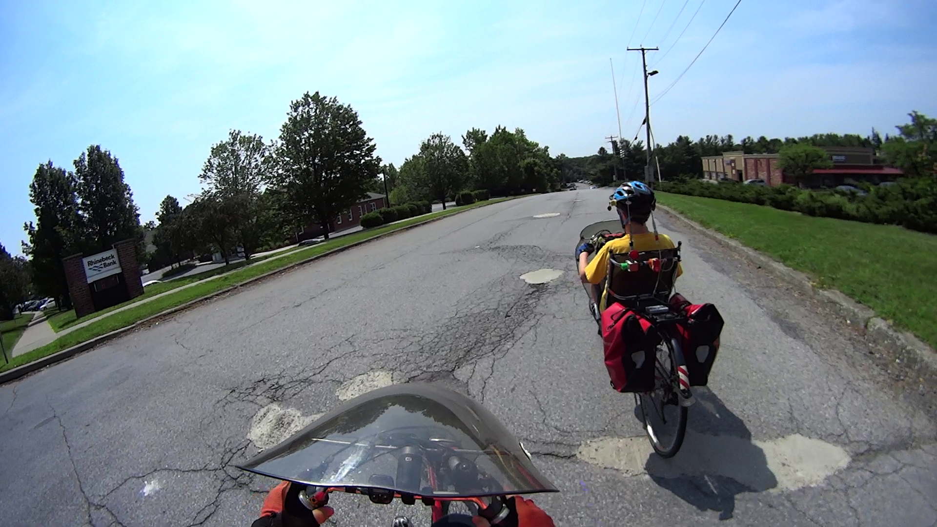
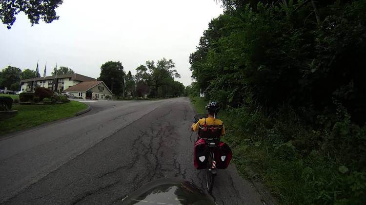
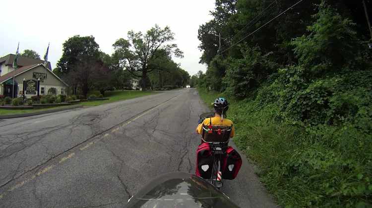
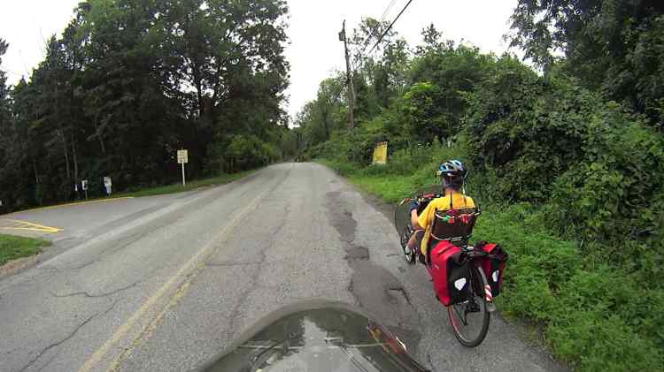
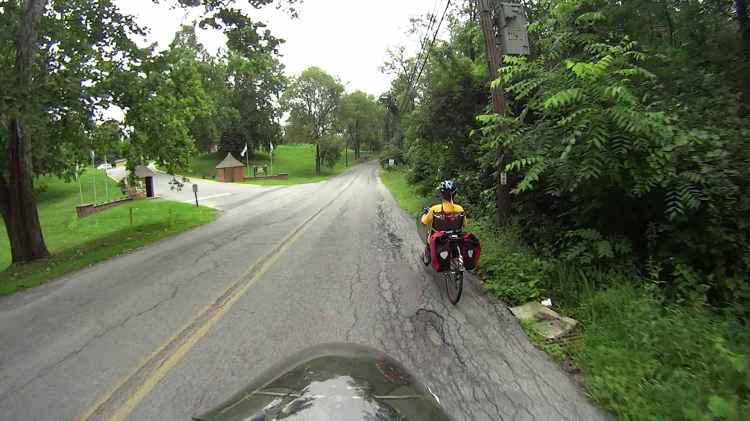
We take the Wappingers section of Maloney Road from Rt 376 to the Dutchess Rail Trail; it’s our main connection to the DCRT for southbound rides.
Here’s a look at 1500 feet of Maloney, starting just uphill from the entrance to the strip mall (click on any image to embiggen and browse the gallery):
Maloney Rd 2015-07-18 – 1
Maloney Rd 2015-07-18 – 2
Maloney Rd 2015-07-18 – 3
Maloney Rd 2015-07-18 – 4
Maloney Rd 2015-07-18 – 5
Maloney Rd 2015-07-18 – 6
Maloney Rd 2015-07-18 – 7
Maloney Rd 2015-07-18 – 8
Many of those longitudinal cracks go down through multiple patch layers and through the original pavement. Rolling your wheel through them would produce an instant upset.
Most drivers give us as much room as they can, but we’ve had some very near misses. Some drivers object loudly to our presence in the middle of the lane, probably because we’re pedaling slowly up the hill, although there’s really no safe path along the right side of the roadway.
The downhill side seems slightly better, but not by very much.
Verily, ImageMagick can do nearly anything you want to an image, as long as you know how to ask for it:
for f in *png ; do convert $f -density 300 -define jpeg:extent=200KB ${f%%.*}.jpg ; done
That converts a directory full of VLC’s video snapshot images from PNG format, which require nigh onto 4 MB each, into correspondingly named JPG files under 200 kB. The image quality may not be the greatest, but it’s good enough to document road hazards in emails.
Rt 376 2015-07-06 – Walker to Maloney – 3
The density option overrides VLC’s default 72 dpi, which doesn’t matter until a program attempts to show the image at “actual size”.
I didn’t realize that the define option existed, but it seems to be how you jam specific controls into the various image coders & decoders. Some of the “artifacts”, well, I can’t even pronounce…
VLC’s snapshot file names look like vlcsnap-2015-07-06-12h10m27s10.png, so bulk renaming and resequencing will be in order.