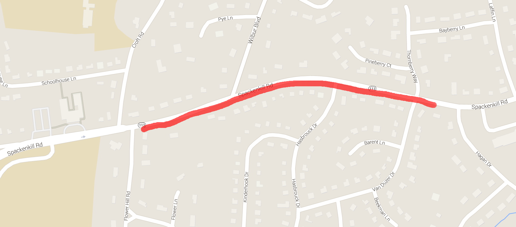
According to the map on page 116 of the “Walk Bike Dutchess” Planning Document, Spackenkill Road has a “Paved Shoulder Width” that’s “Greater than four feet”, but with an asterisk: “Paved width based on available data. May not reflect usable width.” Here’s what “usable width” looks like in actual practice.
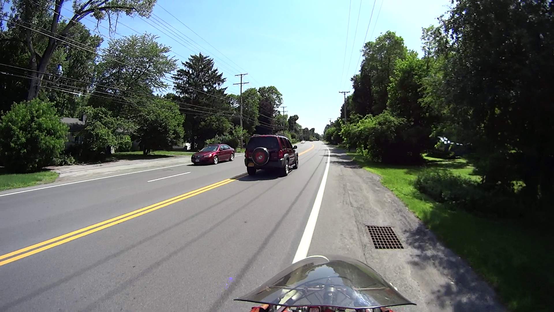
I’m riding eastbound on Spackenkill Road, just past the signal at Croft Road. The shoulder has actually been at least 4 ft wide up to this point, but after Flower Hill Rd the paved surface narrows dramatically:
The right half of the shoulder is a drainage swale that wasn’t repaved along with the rest of the surface; the drain grates just add to the hazard.
This grate features a “bike safe” hex grid. What you can’t see is how far it’s recessed into the asphalt.

Did you notice the manhole cover dead ahead, extending from the fog line across the entire paved part? I did, which is why I’m moving into the travel lane: it’s recessed a few inches into the pavement.
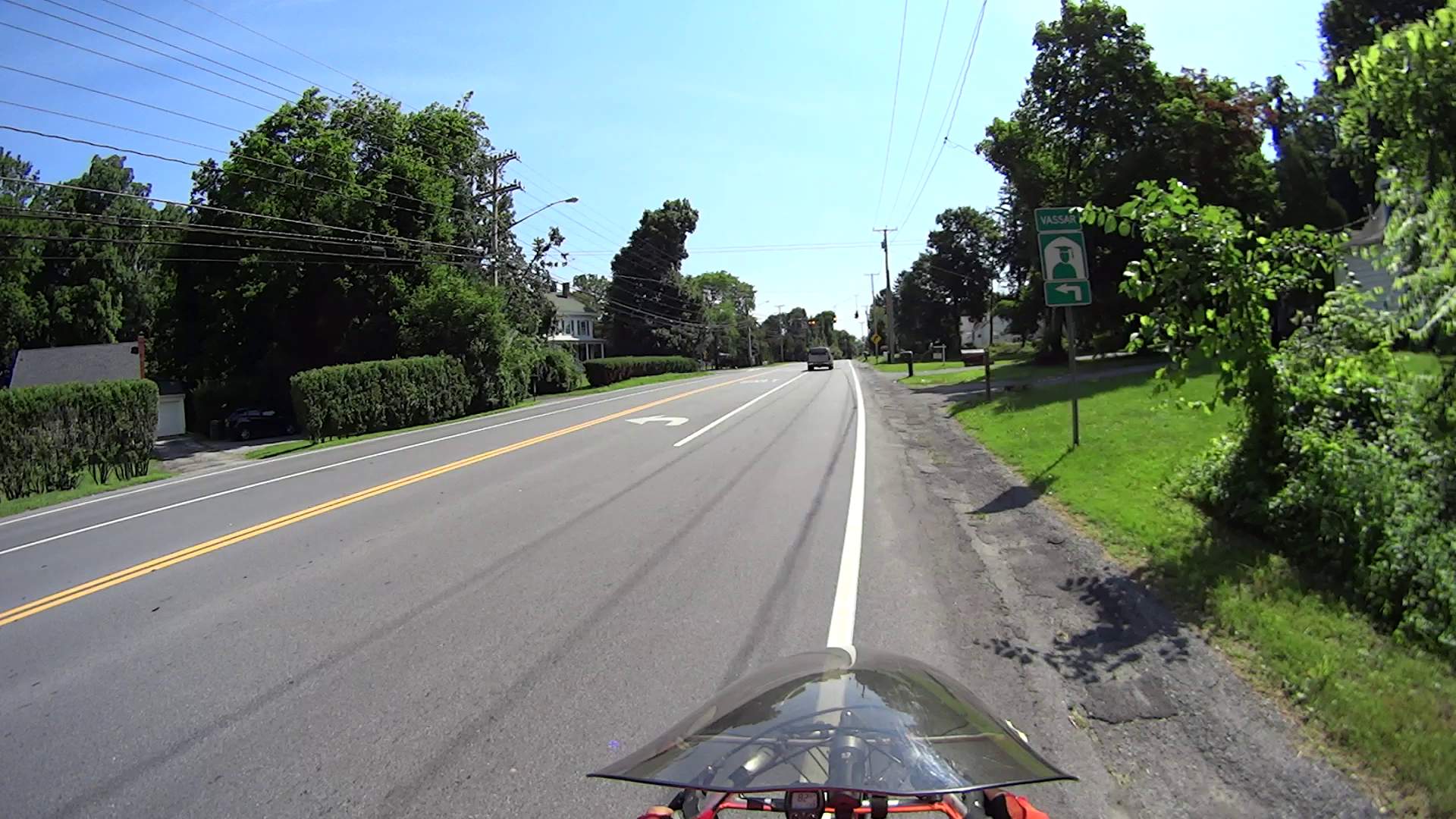
The swale deepens and becomes a patch palimpsest closer to the signal at Wilbur Blvd:
Another manhole cover, recessed on the left and protruding on the right, with a rubble-filled swale requiring riders to move into the traffic lane:

The residual paint on the cover suggests the fog line moved a foot leftward, so the shoulder is slightly wider than it was before the repaving. At this point, the shoulder is a bit over a foot wide, if you ignore the manhole cover and don’t mind riding right up to the edge of the dropoff into the swale.
Just as an aside, why is it when motorists blow a red light, it’s perfectly normal, but when bicyclists do the same thing, they’re maniacs deserving instant death?
That’s why I stop at traffic signals and wait a few seconds before starting.
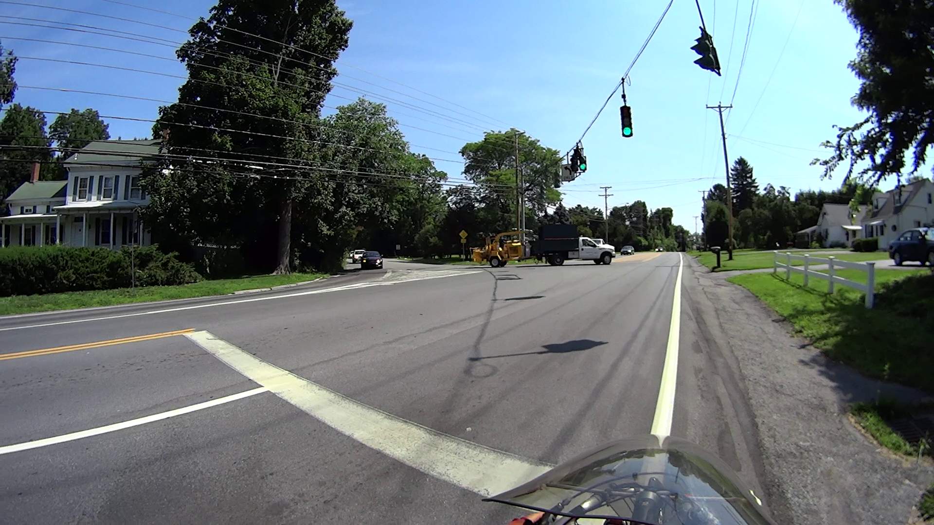
The shoulder gets wider toward Van Duzier, again if you ignore a recessed grate that’s so deep vehicles scratch the far side as they bottom out:

In Dutchess County, you get used to bicycling on whatever pavement you get. I can reliably ride a ledge half a foot wide, but we don’t expect drivers to navigate tiny slices of pavement.
Closing in on Hagan Drive, there’s a slightly concave wheel-trapping grate turned at a jaunty angle, smack in the middle of what surely counts as “more than four feet” of shoulder:

That one’s easy, although if you didn’t like riding close to traffic, you’d be in that gravel patch.
Back in the day, I commuted by bike to IBM along Spackenkill Road. It was in much worse condition with terrible shoulders, so the recent repaving isn’t all that bad. Oddly, back then it was an Official Bike Route with Official Signs; now that it’s improved, it’s no longer marked. Perhaps when NYSDOT gained control of the road, they decided it didn’t meet contemporary bike route standards?
On the whole, Spackenkill is much better than the usual Dutchess County fare.
Should you think that shoulder width isn’t a problem, then you should also have no problem with this deal: send me your paychecks and I will write you checks for anywhere from -25% to +150% of the nominal amount, randomly weighted by the sampled deviation of the shoulder width from four feet along both sides of Spackenkill Road. What say?
It’s not as though a cop will ask you about your average speed when you’re pulled over for speeding: it’s your maximum speed that matters. For bicyclists, it’s the minimum shoulder width and minimum paving standard.
A map with the route (clicky for more dots):
There’s a movie showing the complete ride from IBM Road to Red Oaks Mill.

Comments
11 responses to “Road Conditions: Spackenkill Rd – Eastbound Shoulder – Croft to Hagan”
I have fantasies about creeping out in the middle of the night and actively destroying enough road that they have to come out and repave sections. There’s a long section near the end of my commute where the road surface is beautiful but the bike margin recently had a pipeline run under it so it’s nonstop patches for the last 2 km. It may be okay at sub-20k, but at my 40k cruising rate it’s hard to keep my eyes focussed because I’m bouncing around so hard.
On an only partly related subject, it’d sure be nice if google maps allowed me to mess with their estimated speed settings. Their ETA for in-town is reasonably accurate but once I get out of town onto big long open roads, their ETA’s are like 50% longer than my actual times. I’d like to preserve their dealing-with-stop-signs-and-signals estimates.
And, yeah, hear ya on the red light thing. Because of how and where I drive and ride, I see about 3x as many cars running red lights as bikes. It’d be different if I lived/worked downtown, I’m sure.
Somebody perpetrated guerrilla patches on a road into a mall / apartment / office complex: after far too long, a dozen potholes abruptly filled with something that looks remarkably like Sakrete, rather than the usual asphalt blobs. More power to ’em, but the town really must tackle the crater at the mall entrance.
My riding game is weak; I can barely do that on the flat parts of the rail trail, with the wind at my back. Call it 15-ish mph = 25 km/h for an hour’s ride to / along / from the trail.
Obviously, I need a much better bike or much less weight on the seat. [sigh]
Ride on…
Amen, brother! When I rode, it was a lot, but the vast majority was 15 mph. Did have one time when I mixed in with a group ride and took advantage of the draft. That old mountain bike (Phil hubs, road tires and other stealth features) kept up with some decent road bikes and riders. “Old age and treachery versus youth and vigor.” Ah, the days.
Our recumbents don’t mix well with uprights on group rides: they’re (much) faster on uphills, but we own the downhills & most of the flatland. Drafting doesn’t work well, because we’re invisible when tucked behind a roadie’s back and leave very little wake of our own.
Soooo, we didn’t rejoin the bike club when we moved back here. Before we left Poughkeepsie, we’d been the newsletter editors for nigh onto a decade…
I recently did a 200k with friends and learned a chunk about the joy of 15mph. Man alive that’s a ton more pleasant, especially in the last 50k when I’m not feeling like I’m going to die.
Back in the day, a member of the local bike club rode at a steady 10 mph. She was a Proper Southern Lady, never a hair out of place, but she rode at 10 mph all day long and crushed the heavies by simply outlasting them.
Sometimes, I can do that with a pseudo-roadie on the rail trail who overtakes & passes me in a great rush of wind, only to burn out a mile later. Real roadies, I never see again… [sigh]
And this sort of nonsense is part of why I flat-out refuse to ride in the shoulder anywhere, ever: I an entitled to that lane, and I will damned well use it. The left half of it, too, to discourage assholes from passing me in my lane.
It’s a conundrum, as NYS law says:
Unfortunately, some drivers think cyclists must ride in the gutter, if they ride at all.
Most drivers understand what’s going on, so we have very little day-to-day trouble.
That is an awful, terrible, no good, very bad law and I’m disgusted NYS has it on the books. That said, I am quite certain the shoulder is not a “lane” of any description, bicycle or otherwise, even some fool thought it “usable”…
Aye! In fact, NYSDOT may have removed the Bike Lane signs from Spackenkill specifically so they didn’t get sued by somebody injured on the crappy shoulder sections.
AFAICT, a “shoulder” does not become a “bike lane” until the signs go up. Except, of course, in the opinion of drivers who stopped riding bikes shortly after they outgrew triangular pants…
[…] They started rolling immediately after their signal went green; waiting a second isn’t a universal practice. […]