Ed Nisley's Blog: Shop notes, electronics, firmware, machinery, 3D printing, laser cuttery, and curiosities. Contents: 100% human thinking, 0% AI slop.
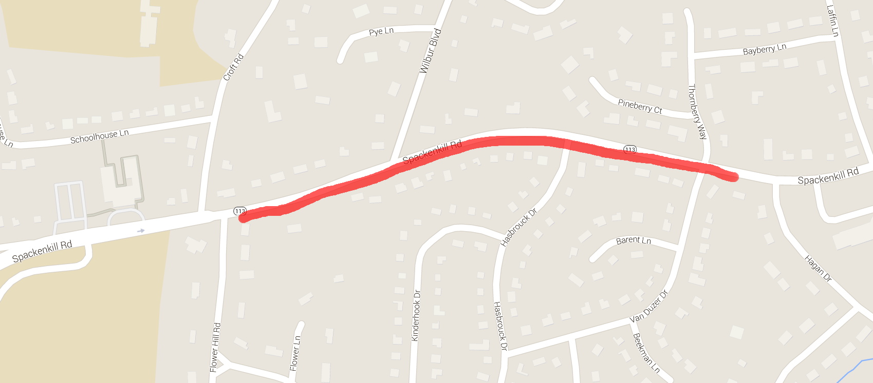
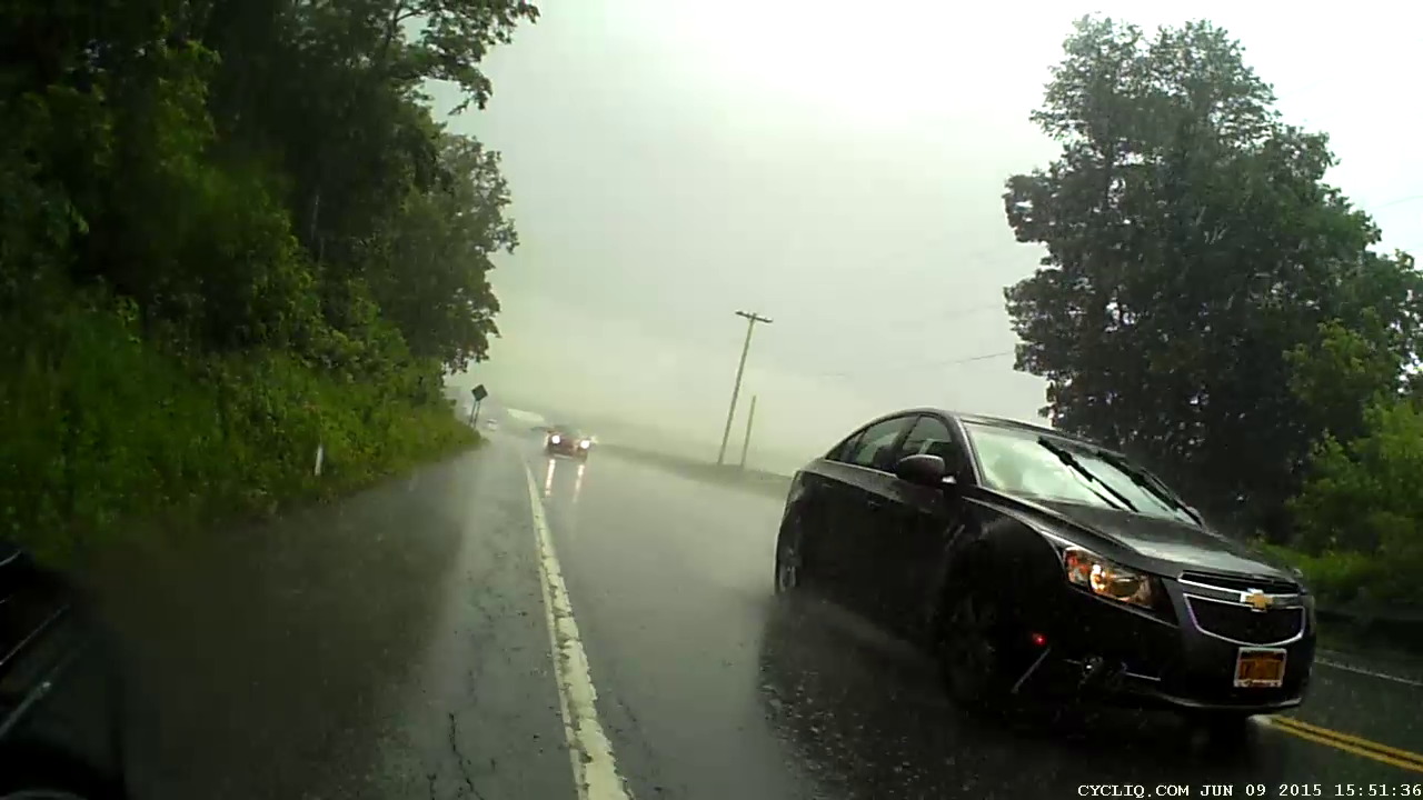
According to the map on page 116 of the “Walk Bike Dutchess” Planning Document, Spackenkill Road has a “Paved Shoulder Width” that’s “Greater than four feet”, but with an asterisk: “Paved width based on available data. May not reflect usable width.” Here’s what “usable width” looks like in actual practice.
I’m riding eastbound on Spackenkill Road, just past the signal at Croft Road. The shoulder has actually been at least 4 ft wide up to this point, but after Flower Hill Rd the paved surface narrows dramatically:
Spackenkill Rd EB – Croft to Hagan – 1
The right half of the shoulder is a drainage swale that wasn’t repaved along with the rest of the surface; the drain grates just add to the hazard.
This grate features a “bike safe” hex grid. What you can’t see is how far it’s recessed into the asphalt.
Spackenkill Rd EB – Croft to Hagan – 2
Did you notice the manhole cover dead ahead, extending from the fog line across the entire paved part? I did, which is why I’m moving into the travel lane: it’s recessed a few inches into the pavement.
The swale deepens and becomes a patch palimpsest closer to the signal at Wilbur Blvd:
Spackenkill Rd EB – Croft to Hagan – 3
Another manhole cover, recessed on the left and protruding on the right, with a rubble-filled swale requiring riders to move into the traffic lane:
Spackenkill Rd EB – Croft to Hagan – 4
The residual paint on the cover suggests the fog line moved a foot leftward, so the shoulder is slightly wider than it was before the repaving. At this point, the shoulder is a bit over a foot wide, if you ignore the manhole cover and don’t mind riding right up to the edge of the dropoff into the swale.
Just as an aside, why is it when motoristsblow a red light, it’s perfectly normal, but when bicyclists do the same thing, they’re maniacs deserving instant death?
Spackenkill Rd EB – Croft to Hagan – 5
That’s why I stop at traffic signals and wait a few seconds before starting.
The shoulder gets wider toward Van Duzier, again if you ignore a recessed grate that’s so deep vehicles scratch the far side as they bottom out:
Spackenkill Rd EB – Croft to Hagan – 6
In Dutchess County, you get used to bicycling on whatever pavement you get. I can reliably ride a ledge half a foot wide, but we don’t expect drivers to navigate tiny slices of pavement.
Closing in on Hagan Drive, there’s a slightly concave wheel-trapping grate turned at a jaunty angle, smack in the middle of what surely counts as “more than four feet” of shoulder:
Spackenkill Rd EB – Croft to Hagan – 7
That one’s easy, although if you didn’t like riding close to traffic, you’d be in that gravel patch.
Back in the day, I commuted by bike to IBM along Spackenkill Road. It was in much worse condition with terrible shoulders, so the recent repaving isn’t all that bad. Oddly, back then it was an Official Bike Route with Official Signs; now that it’s improved, it’s no longer marked. Perhaps when NYSDOT gained control of the road, they decided it didn’t meet contemporary bike route standards?
On the whole, Spackenkill is much better than the usual Dutchess County fare.
Should you think that shoulder width isn’t a problem, then you should also have no problem with this deal: send me your paychecks and I will write you checks for anywhere from -25% to +150% of the nominal amount, randomly weighted by the sampled deviation of the shoulder width from four feet along both sides of Spackenkill Road. What say?
It’s not as though a cop will ask you about your average speed when you’re pulled over for speeding: it’s your maximum speed that matters. For bicyclists, it’s the minimum shoulder width and minimum paving standard.
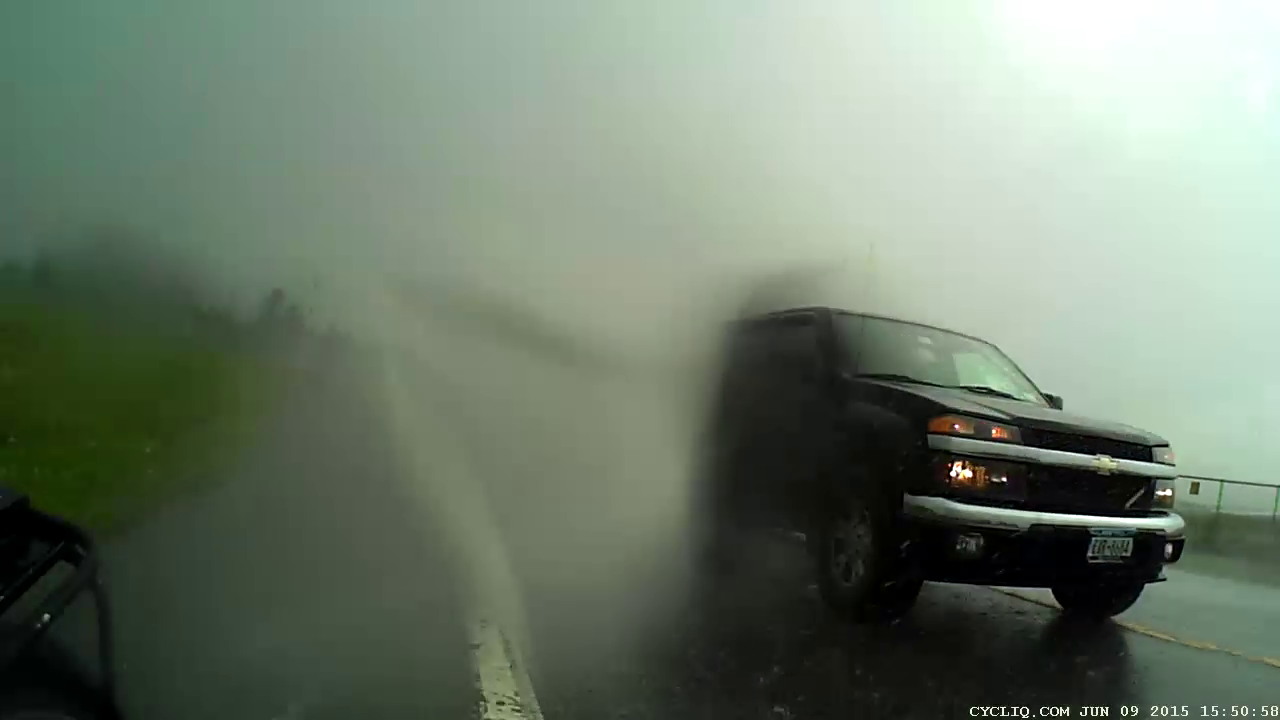
Cycliq says “Using the latest nanotechnology, Fly6 is safeguarded against any wet weather nature can throw at you.” That’s not quite the same as saying it’s waterproof, but the plastic lens cover sheds water surprisingly well.
We were caught in a brief downpour on a recent ride and, not unexpectedly, water covered the rear-facing lens:
Fly6 – Rain 1
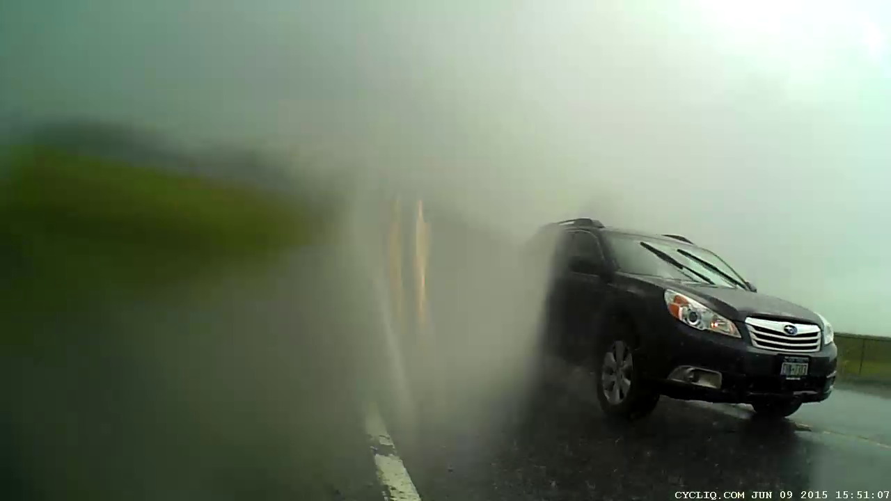
A larger drop ran down the left side, merged with the previous drop, and blurred two thirds of the image:
Fly6 – Rain 2
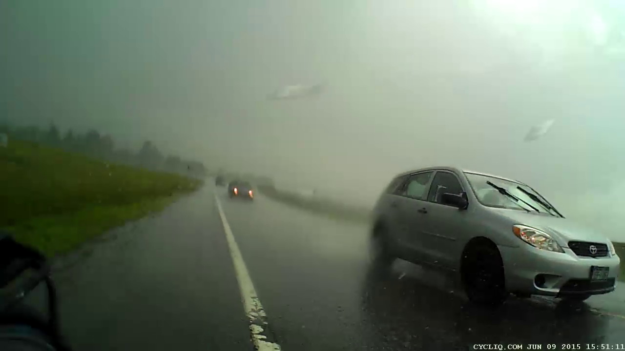
Three seconds and a few major jolts later, the lens was mostly clear:
Fly6 – Rain 3
Half a minute later, it’s looking even better:
Fly6 – Rain 4
The jolts come from the deteriorated paving and poor patches along Rt 376, but at least they shake the water off the lens:
Fly6 – Rain 5
Ten minutes after the first image, both the lens and the sky were almost completely clear:
Fly6 – Rain 6
A pleasant surprise!
That transverse crack just behind me? Charlie Brown’s First Principle of Puddles applies: you cannot tell how deep a puddle is from the top. That sucker goes down through at least three layers of paving:
Crack – Red Oaks Mill
I forgot to put the Sony HDR-AS30V helmet camera in its waterproof housing before we left, so I put it in the (not exactly waterproof, either) underseat pack when the first drops fell. Sony makes no pretense that the bare camera can survive a rainstorm, but the packs are good for our simple needs.
Ed’s First Principle of Rain Riding: After the first five minutes, you don’t get any wetter.
A few minutes after we started riding, an insect collided with my helmet. About 3/60 second before impact:
HDR-AS30V 1280×720-60 – Insect – crop
We paused in a park at the far end of the ride, rolled out, and another insect buzzed past:
HDR-AS30V 1280×720-60 – Insect 2 – crop
Both of those flew within a few inches of the lens, far inside the camera’s fixed-focus near point, and it’s a wonder they look as good as they do. Looking at successive frames reveals wingbeats, although they’re surely flapping much faster than frame rate and therefore heavily aliased.
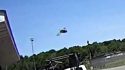
Fortunately, a Gas Hawk didn’t come that close:
Rt 376 – Dutchess Airport – landing
All from the Sony HDR-AS30V in 1280×720 at 60 frame/s. The bug images were ruthlessly cropped to show the full-size dot-for-dot camera image, then stored with minimal compression.
This isn’t the first time I’ve been buzzed on the bike, but it’s a record for one ride.
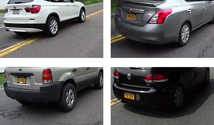
With the Sony HDR-AS30V on my helmet set to 1280×720 at 120 frame/sec, the plates on passing cars remain barely readable (clicky for more dots):
HDR-AS30V – license plates – 1280×720-120
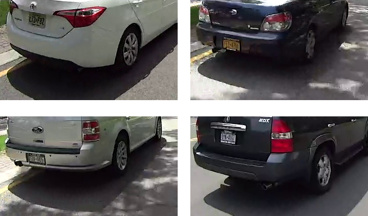
Throttling the camera back to 60 f/s produces slightly better results:
HDR-AS30V – license plates – 1280×720-60
The differences seem due more to changing lighting conditions than frame rate: the camera definitely produces better results in bright, direct sunlight.
These are about as good as it gets and, if you look carefully at the images, you can see plenty of compression artifacts that wipe out small details.
Equal-size dot-for-dot crops from the original 1280×720 images, matted together, and very lightly compressed because there’s not much detail to compress…
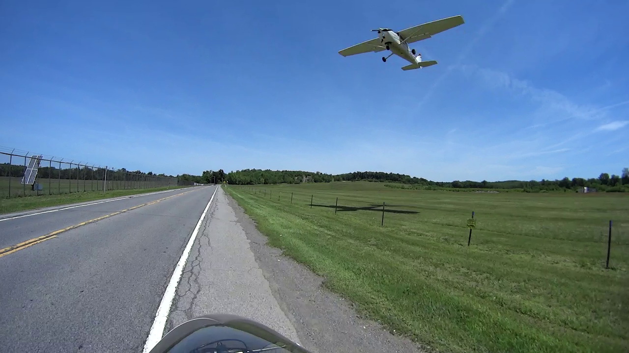
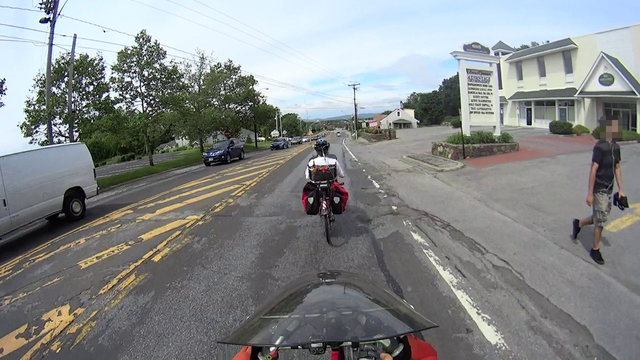
Unfortunately, US Rt 44 is the only way to get from Adams Fairacre to the Stop & Shop, so we ride this section once a week. I’m towing the trailer with two bags of groceries:
Rt 44 – 695 at Quest Diagnostics – pedestrian
A palimpsest of patches shows that they really don’t have staying power:
Rt 44 – 695 at Quest Diagnostics – deterioration
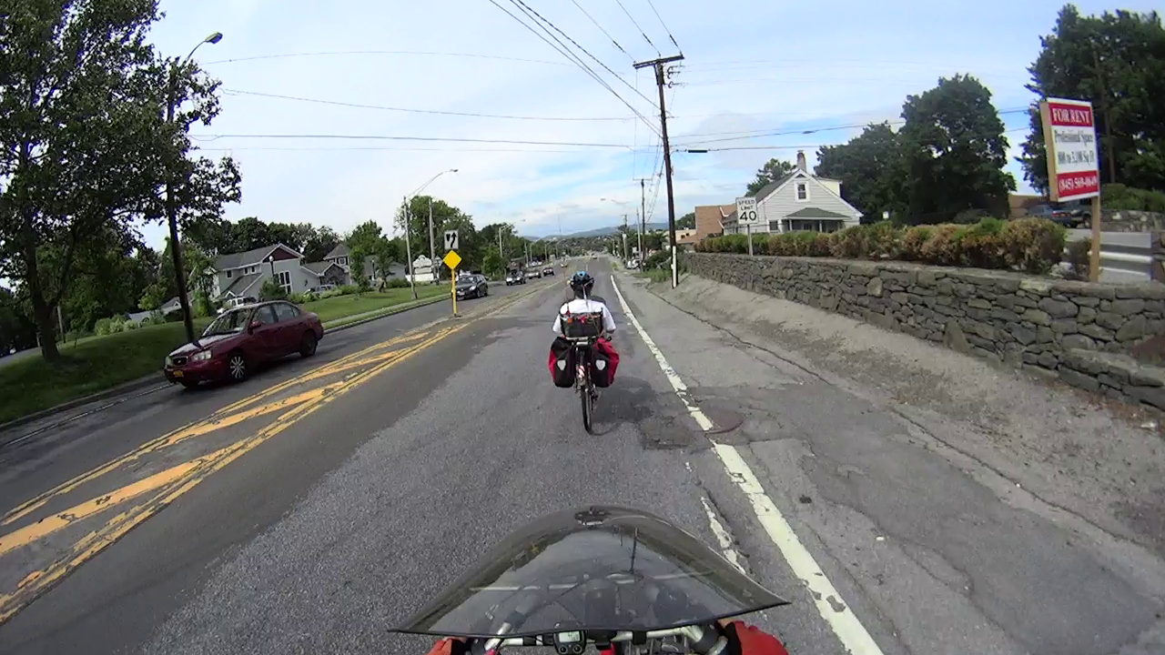
Gravel and a manhole cover keep cyclists off the shoulder:
Rt 44 – 695 at Quest Diagnostics – patching
We take the lane well before we encounter this section, because veering into traffic doesn’t work well:
Rt 44 – 695 at Quest Diagnostics – traffic
The longitudinal crack marks the edge of the original paving. This is a common hazard on Dutchess County roads, as many were widened by simply paving the original shoulders into the travel lane, without actually rebuilding the substructure.
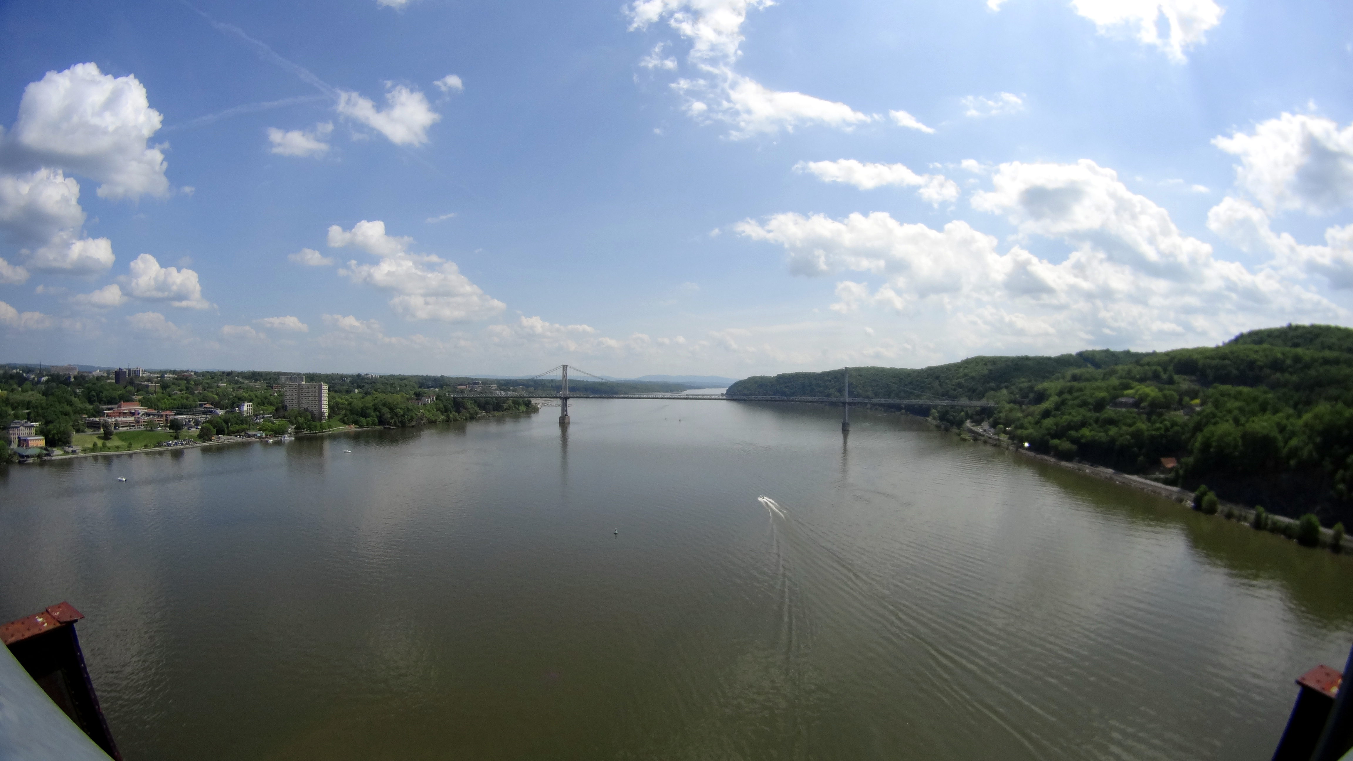
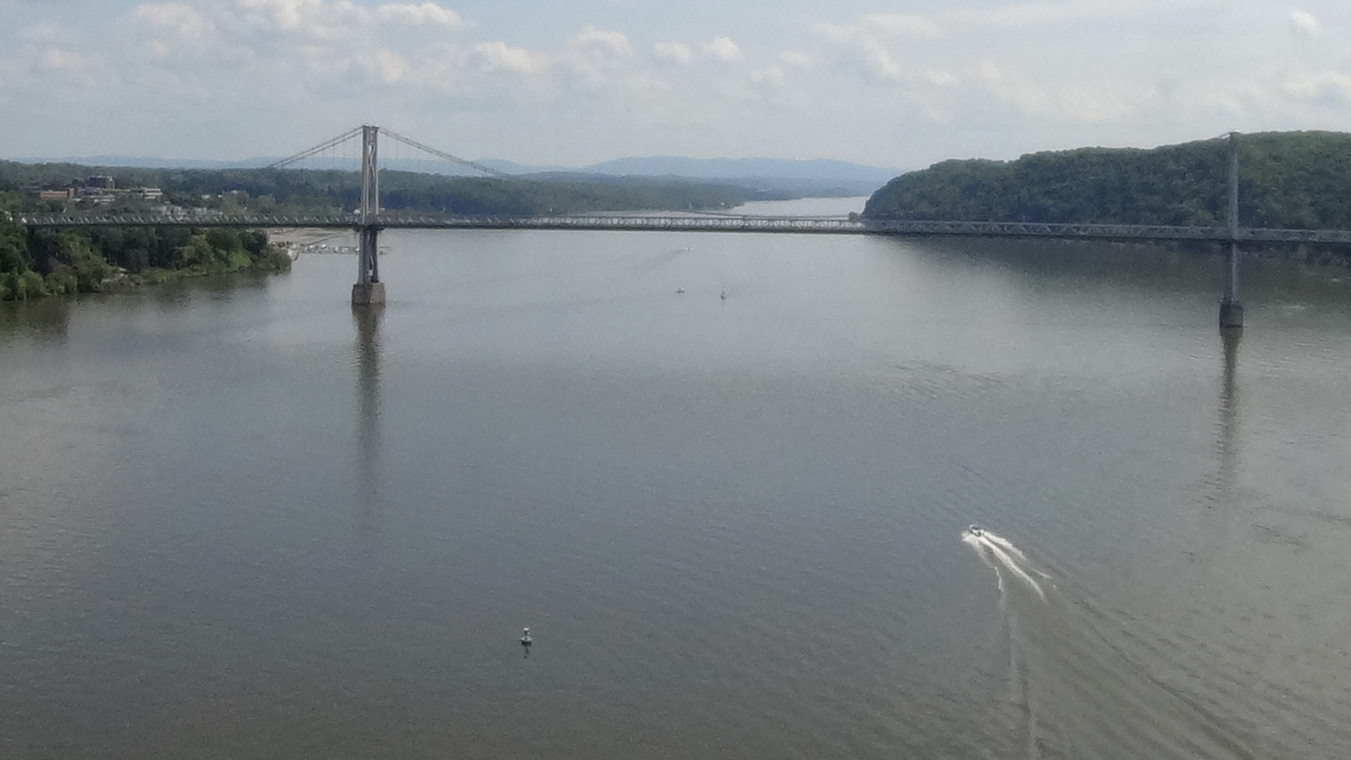
Walkway South View – Sony HDR-AS30V still image – detail
The thing has absolutely no affordance for hand-holding, so perching it on the Walkway handrail 200 feet over the Hudson required tamping down my usual risk aversion.
Both images have been slightly contrast-tweaked and lightly compressed from the original data, but not by enough to matter here. Generally, I apply ruthless compression to keep the image size under control, so these look a lot better than the usual pix around here.