Ed Nisley's Blog: Shop notes, electronics, firmware, machinery, 3D printing, laser cuttery, and curiosities. Contents: 100% human thinking, 0% AI slop.
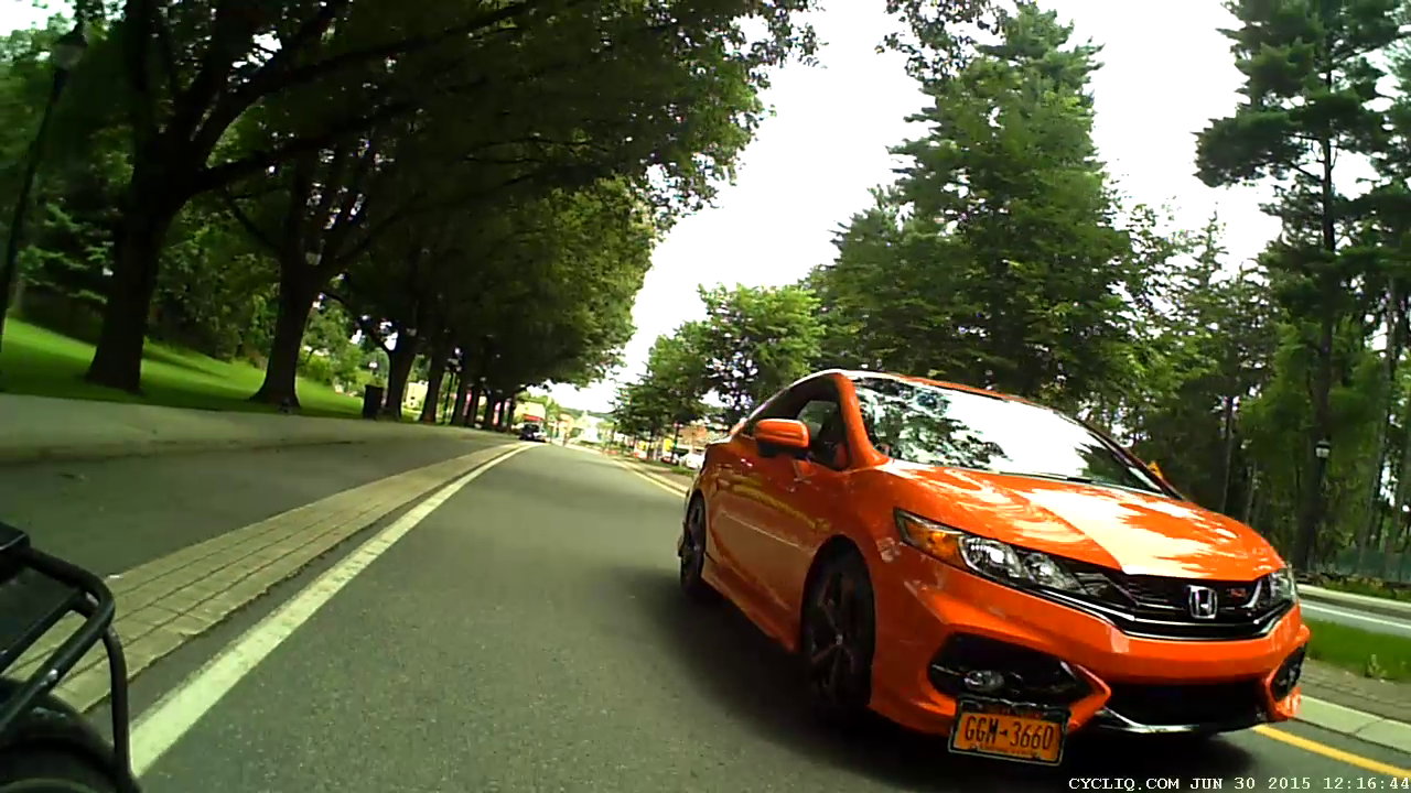
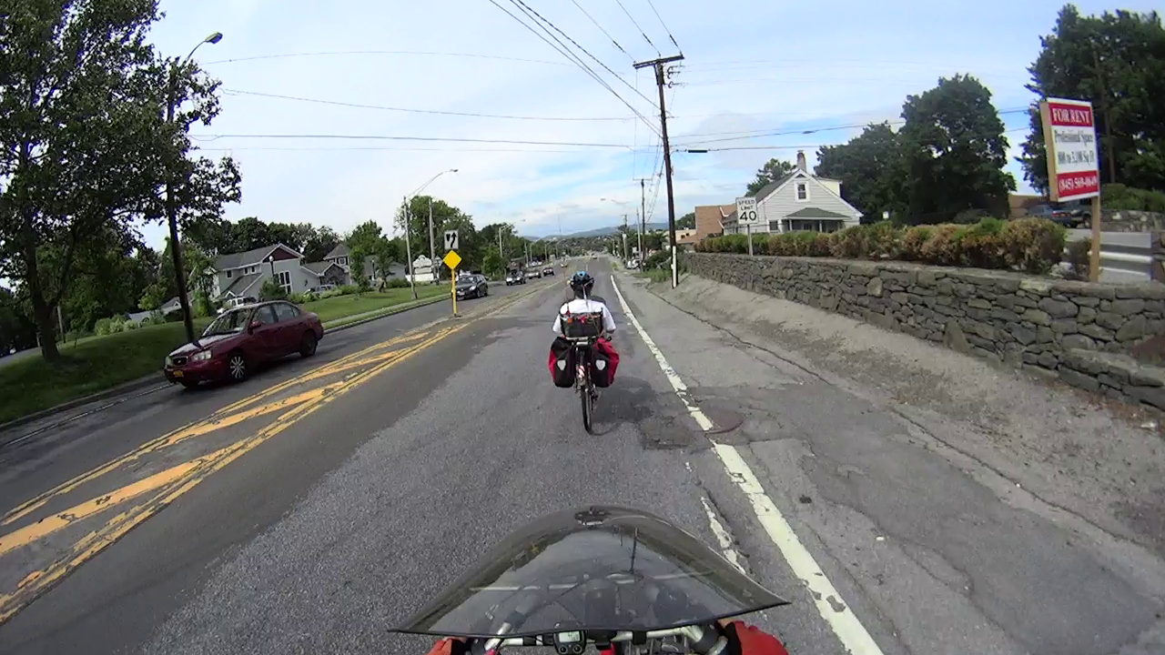
A few days after I didn’t get sideswiped at the Vassar Main Entrance Rotary, we were returning from errands. Traffic is light, but Raymond Avenue doesn’t provide much clearance. This orange car is about as far away as one can expect:
Raymond Ave 2015-06-30 – door opening – 0
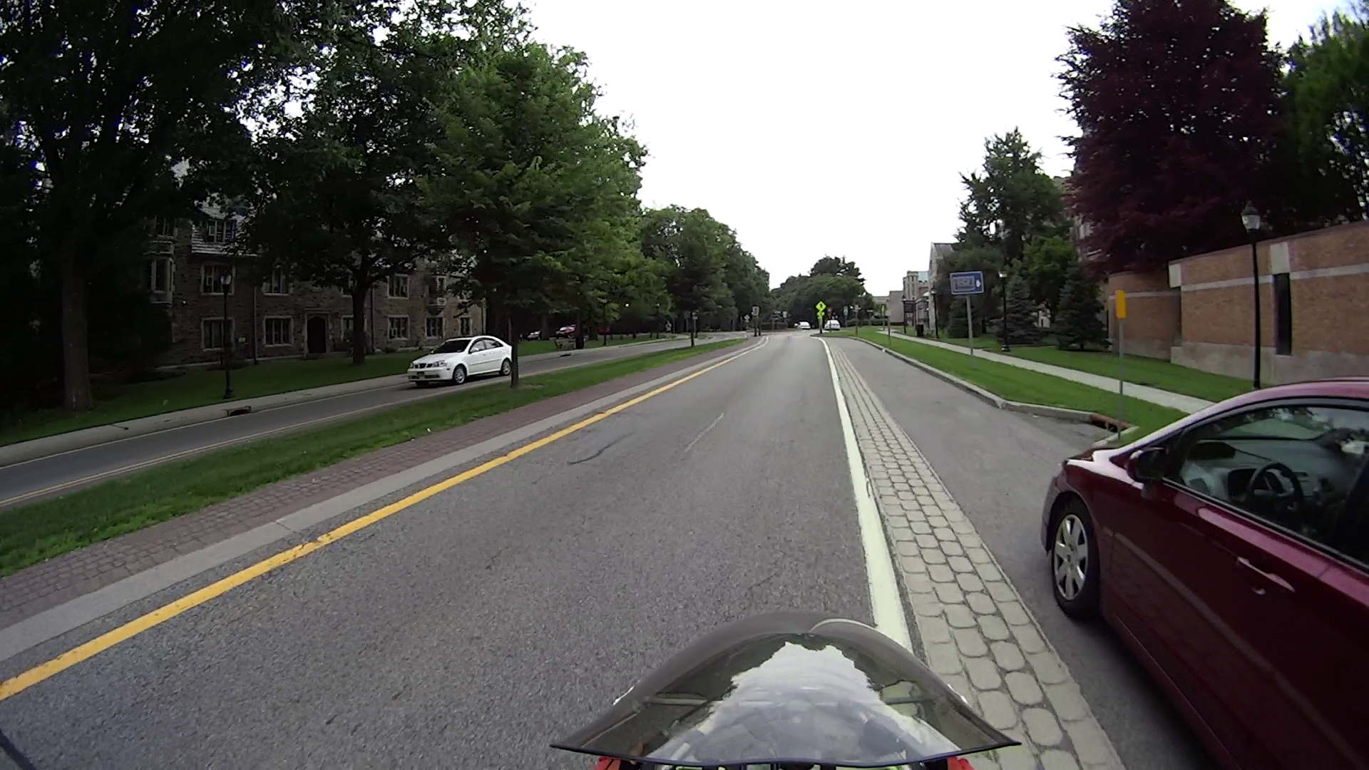
Two seconds later, however, there’s a door opening ahead of Mary (clicky for more dots):
Raymond Ave 2015-06-30 – door opening – 1
I’m shouting “DOOR! DOOR! DOOR!” in the hopes that the driver won’t step directly in front of Mary, but most likely the orange car whooshing by three feet away made more difference:
Raymond Ave 2015-06-30 – door opening – 2
Fortunately, there wasn’t any overtaking traffic and, during the four seconds after the orange car passed us, we could move to the left:
Raymond Ave 2015-06-30 – door opening – 3
The driver’s body language suggested that, until we passed her, she remained oblivious to the outside world and, in fact, she was probably annoyed that two cyclists came that close to her.
“Sharing the road” requires two parties. Raymond Avenue’s design doesn’t encourage motorists to share the road and certainly doesn’t provide a fair playing field for the most unprotected party in the transaction.
Broken by design, I’d call Raymond Avenue, and that’s pretty much what NYSDOT’s original planning documents admit.
The “Share the Road” sign tells you how NYSDOT intended that Raymond Avenue should work:
Raymond Ave 2015-06-27 – Vassar Main Entrance – 0
I’m just about to enter the traffic circle /rotary / roundabout in front of the Vassar College main entrance:
Raymond Ave 2015-06-27 – Vassar Main Entrance – 1a
The catch basin recess just in front of the car is 150 feet from the pedestrian zebra stripe at the rotary entrance. I’m pedaling at about 18 mph = 25 ft/s, my usual speed on that section, so the rotary is six seconds away.
Despite the cobbled strip adjacent to the parked car, I’m riding well within the door strike zone, which is pretty much where cyclists must ride on Raymond in order to not impede traffic flow. I was about to signal before taking the lane into the rotary, but a glance in the mirror (copied by the Fly6 aft camera) shows I’m too late:
Raymond Ave 2015-06-27 – Vassar Main Entrance – 1b
As always, motorists plan on squeezing past me and getting through the rotary before I arrive, presumably figuring that I can share the road with them both into and through the rotary. That doesn’t take into account the fact that vehicles must speed up to pass me at more than 18 mph, slow down before the rotary entrance, then veer right around the central island. Given, say, 300 feet, that’s 12 seconds, which isn’t really all that long.
Under ordinary circumstances, I can pass through the rotary by backing off on the pedaling and coasting, without slowing very much at all, occupying the entire lane. If there’s oncoming traffic, then I plan to stop at the Yield sign, an event which often takes motorists by surprise.
Three seconds later, with the entrance barely two car lengths ahead, we’re both braking hard:
Raymond Ave 2015-06-27 – Vassar Main Entrance – 2
The rotary entrance lane squeeze just ahead slows motor vehicles and channels them in the proper direction around the central island, a bike-unsafe design that mashes cyclists right up against the side of improperly passing vehicles.
After another four seconds, we’re both almost stopped, which is a Very Good Thing for me, because I can’t tell if they’re going straight or, hey, about to turn right into the Vassar Main Gate without the formality of signaling:
Raymond Ave 2015-06-27 – Vassar Main Entrance – 3
You can’t hear me shouting “GO! GO! GO!” to encourage them to get the hell out of the rotary. For sure, I am not going to pass them on the right.
As it turned out, the driver continued straight through the rotary, then parked close to the Juliet, along with the car following them, which was a few feet behind me in the last picture. I decided that stopping by the driver’s window and asking if he / she / it understood what just happened would not be a productive use of anyone’s time.
Speaking of time, if seven seconds sounds ample for evasive maneuvering, bring your bike over and let’s do some riding.
There’s nothing like a shot of adrenaline to perk up one’s pedaling…
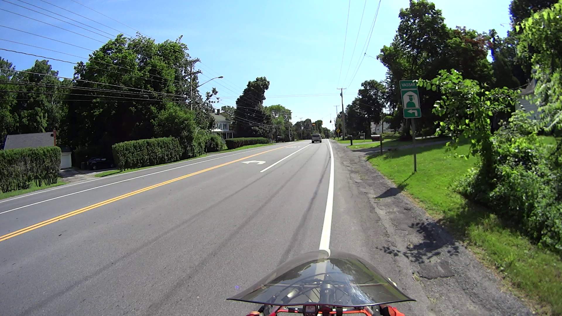
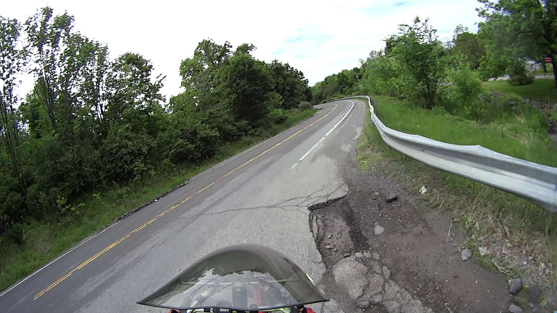
According to the map on page 116 of the “Walk Bike Dutchess” Planning Document, Spackenkill Road has a “Paved Shoulder Width” that’s “Greater than four feet”, but with an asterisk: “Paved width based on available data. May not reflect usable width.” Here’s what “usable width” looks like in actual practice.
I’m riding eastbound on Spackenkill Road, just past the signal at Croft Road. The shoulder has actually been at least 4 ft wide up to this point, but after Flower Hill Rd the paved surface narrows dramatically:
Spackenkill Rd EB – Croft to Hagan – 1
The right half of the shoulder is a drainage swale that wasn’t repaved along with the rest of the surface; the drain grates just add to the hazard.
This grate features a “bike safe” hex grid. What you can’t see is how far it’s recessed into the asphalt.
Spackenkill Rd EB – Croft to Hagan – 2
Did you notice the manhole cover dead ahead, extending from the fog line across the entire paved part? I did, which is why I’m moving into the travel lane: it’s recessed a few inches into the pavement.
The swale deepens and becomes a patch palimpsest closer to the signal at Wilbur Blvd:
Spackenkill Rd EB – Croft to Hagan – 3
Another manhole cover, recessed on the left and protruding on the right, with a rubble-filled swale requiring riders to move into the traffic lane:
Spackenkill Rd EB – Croft to Hagan – 4
The residual paint on the cover suggests the fog line moved a foot leftward, so the shoulder is slightly wider than it was before the repaving. At this point, the shoulder is a bit over a foot wide, if you ignore the manhole cover and don’t mind riding right up to the edge of the dropoff into the swale.
Just as an aside, why is it when motoristsblow a red light, it’s perfectly normal, but when bicyclists do the same thing, they’re maniacs deserving instant death?
Spackenkill Rd EB – Croft to Hagan – 5
That’s why I stop at traffic signals and wait a few seconds before starting.
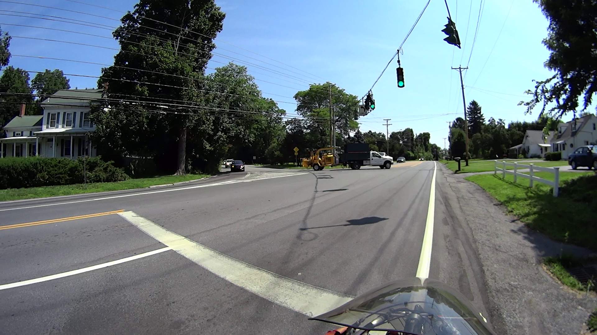
The shoulder gets wider toward Van Duzier, again if you ignore a recessed grate that’s so deep vehicles scratch the far side as they bottom out:
Spackenkill Rd EB – Croft to Hagan – 6
In Dutchess County, you get used to bicycling on whatever pavement you get. I can reliably ride a ledge half a foot wide, but we don’t expect drivers to navigate tiny slices of pavement.
Closing in on Hagan Drive, there’s a slightly concave wheel-trapping grate turned at a jaunty angle, smack in the middle of what surely counts as “more than four feet” of shoulder:
Spackenkill Rd EB – Croft to Hagan – 7
That one’s easy, although if you didn’t like riding close to traffic, you’d be in that gravel patch.
Back in the day, I commuted by bike to IBM along Spackenkill Road. It was in much worse condition with terrible shoulders, so the recent repaving isn’t all that bad. Oddly, back then it was an Official Bike Route with Official Signs; now that it’s improved, it’s no longer marked. Perhaps when NYSDOT gained control of the road, they decided it didn’t meet contemporary bike route standards?
On the whole, Spackenkill is much better than the usual Dutchess County fare.
Should you think that shoulder width isn’t a problem, then you should also have no problem with this deal: send me your paychecks and I will write you checks for anywhere from -25% to +150% of the nominal amount, randomly weighted by the sampled deviation of the shoulder width from four feet along both sides of Spackenkill Road. What say?
It’s not as though a cop will ask you about your average speed when you’re pulled over for speeding: it’s your maximum speed that matters. For bicyclists, it’s the minimum shoulder width and minimum paving standard.
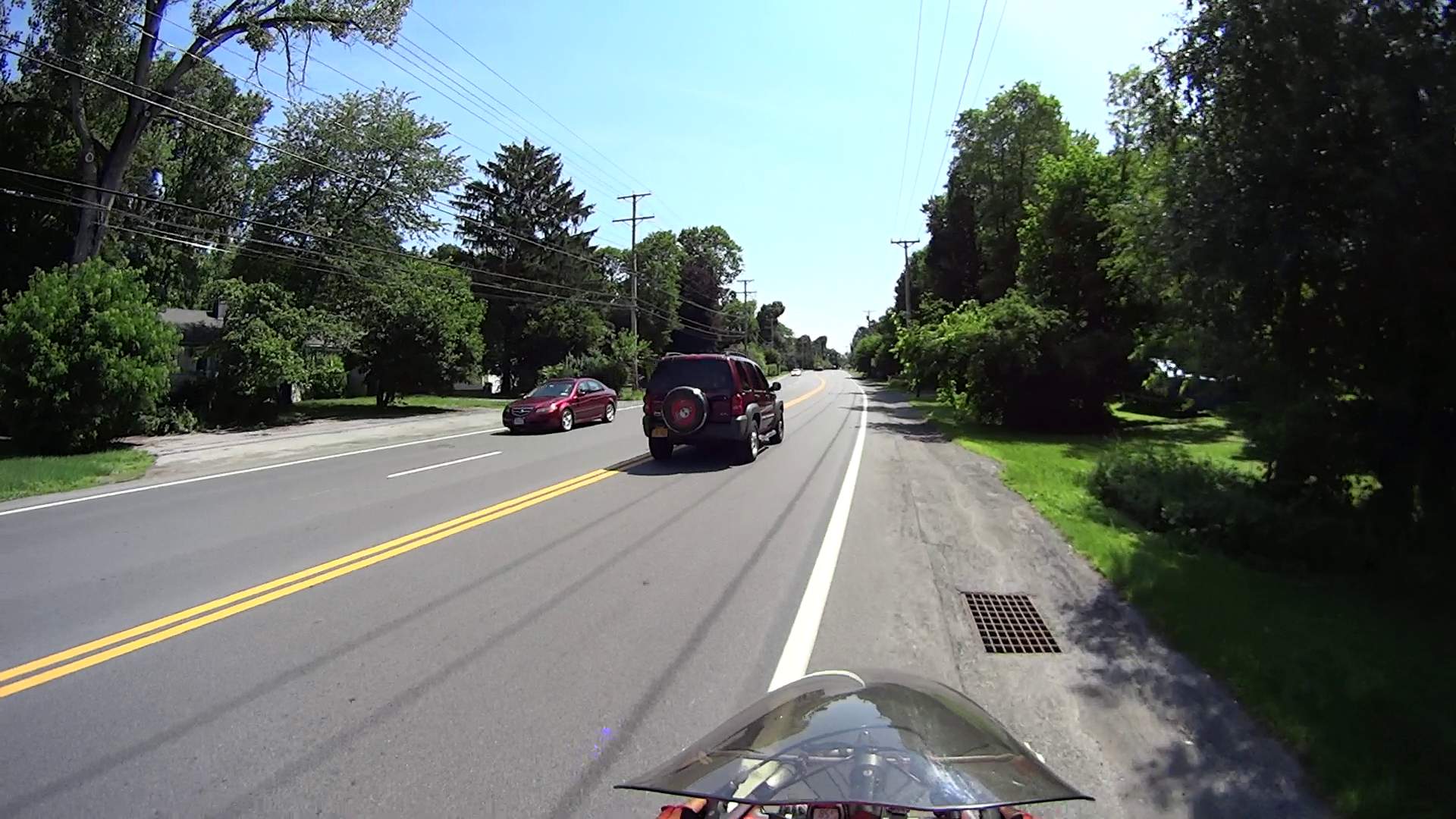
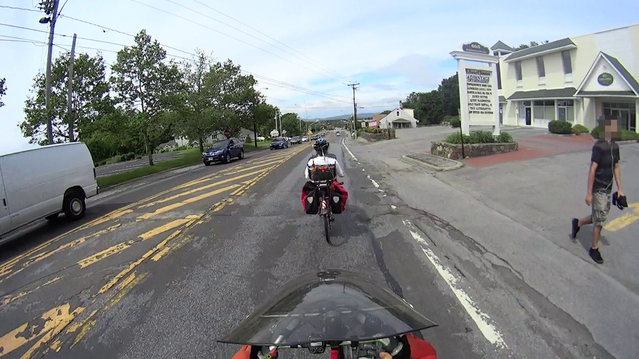
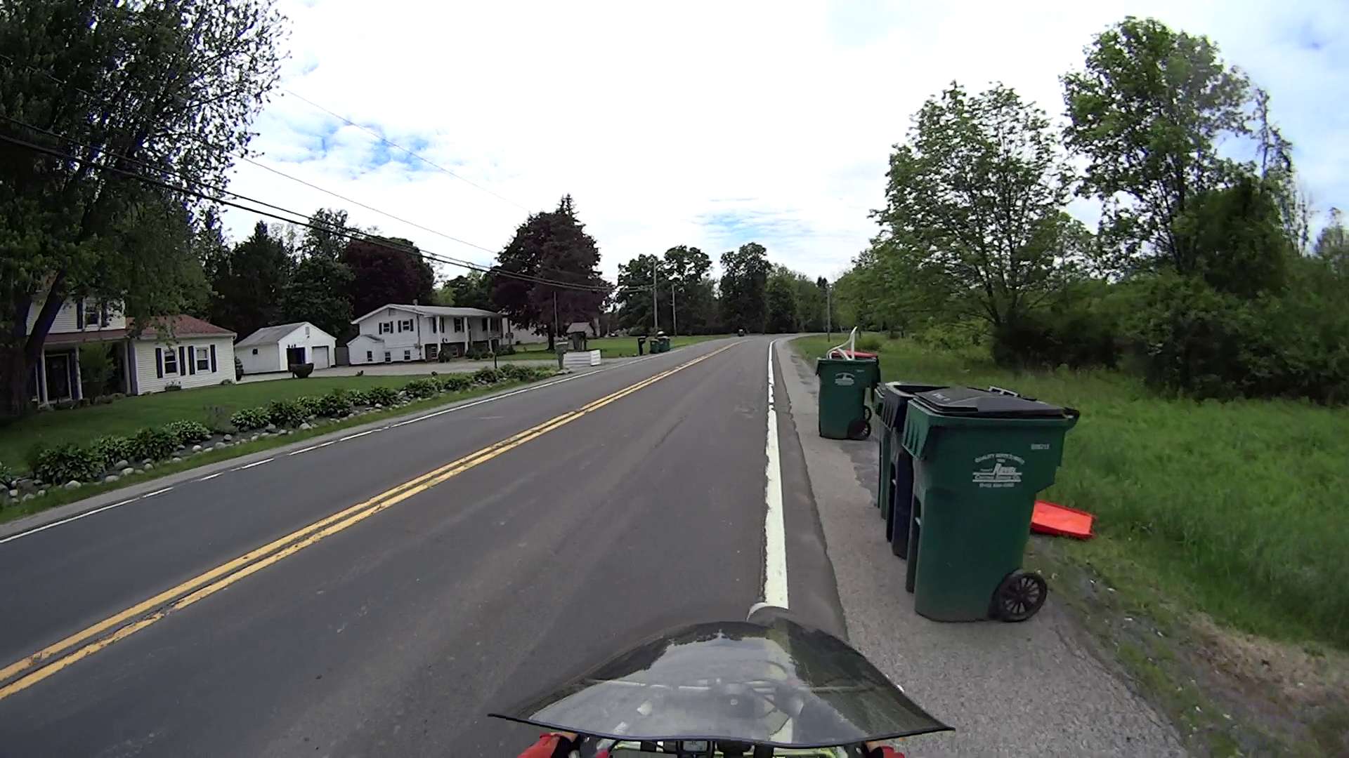
Unfortunately, US Rt 44 is the only way to get from Adams Fairacre to the Stop & Shop, so we ride this section once a week. I’m towing the trailer with two bags of groceries:
Rt 44 – 695 at Quest Diagnostics – pedestrian
A palimpsest of patches shows that they really don’t have staying power:
Rt 44 – 695 at Quest Diagnostics – deterioration
Gravel and a manhole cover keep cyclists off the shoulder:
Rt 44 – 695 at Quest Diagnostics – patching
We take the lane well before we encounter this section, because veering into traffic doesn’t work well:
Rt 44 – 695 at Quest Diagnostics – traffic
The longitudinal crack marks the edge of the original paving. This is a common hazard on Dutchess County roads, as many were widened by simply paving the original shoulders into the travel lane, without actually rebuilding the substructure.
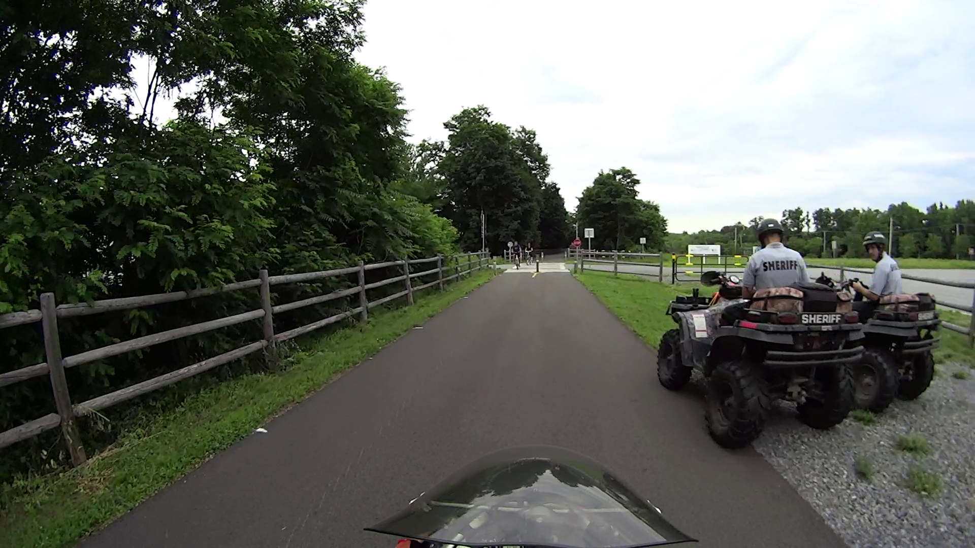
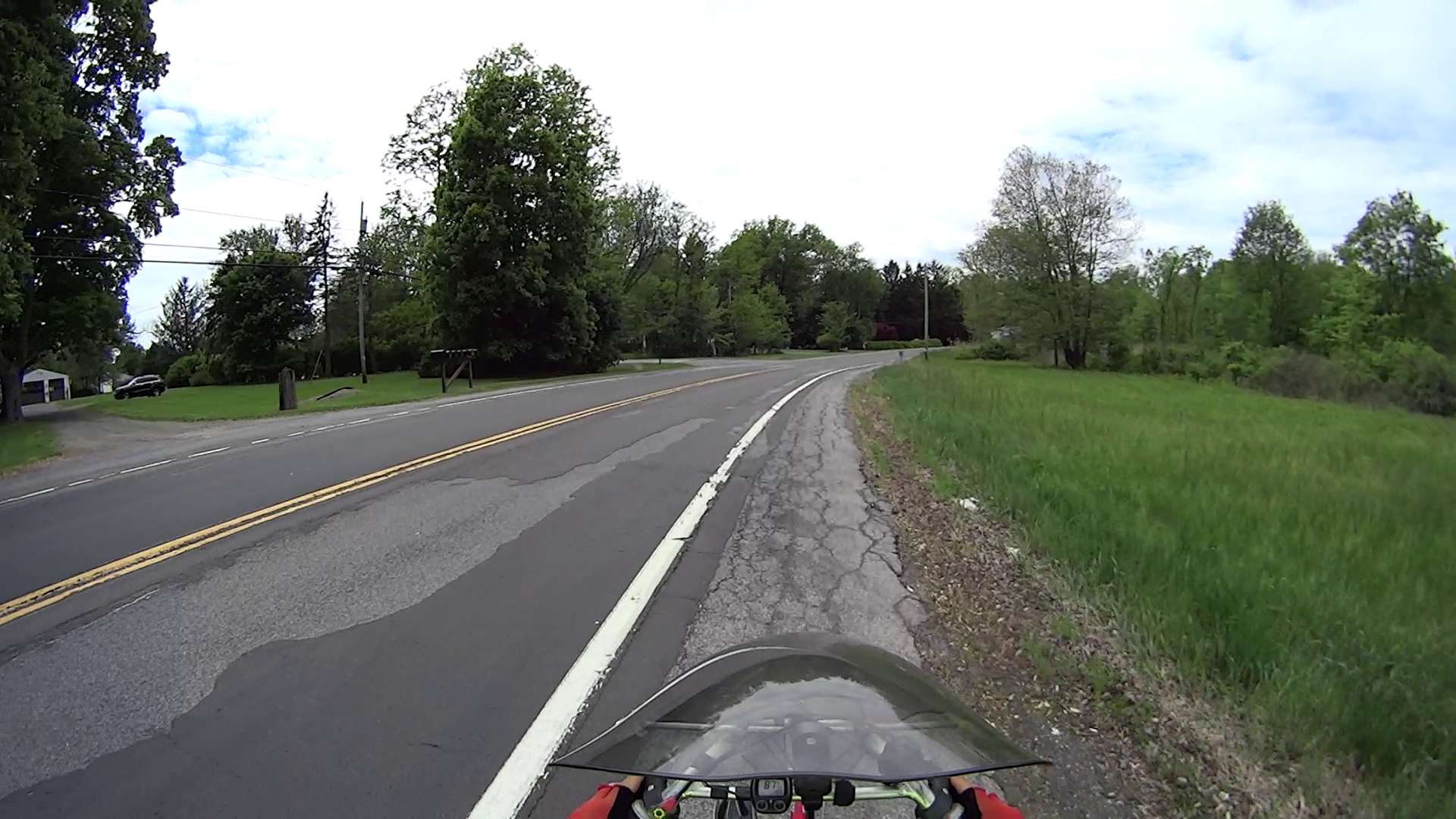
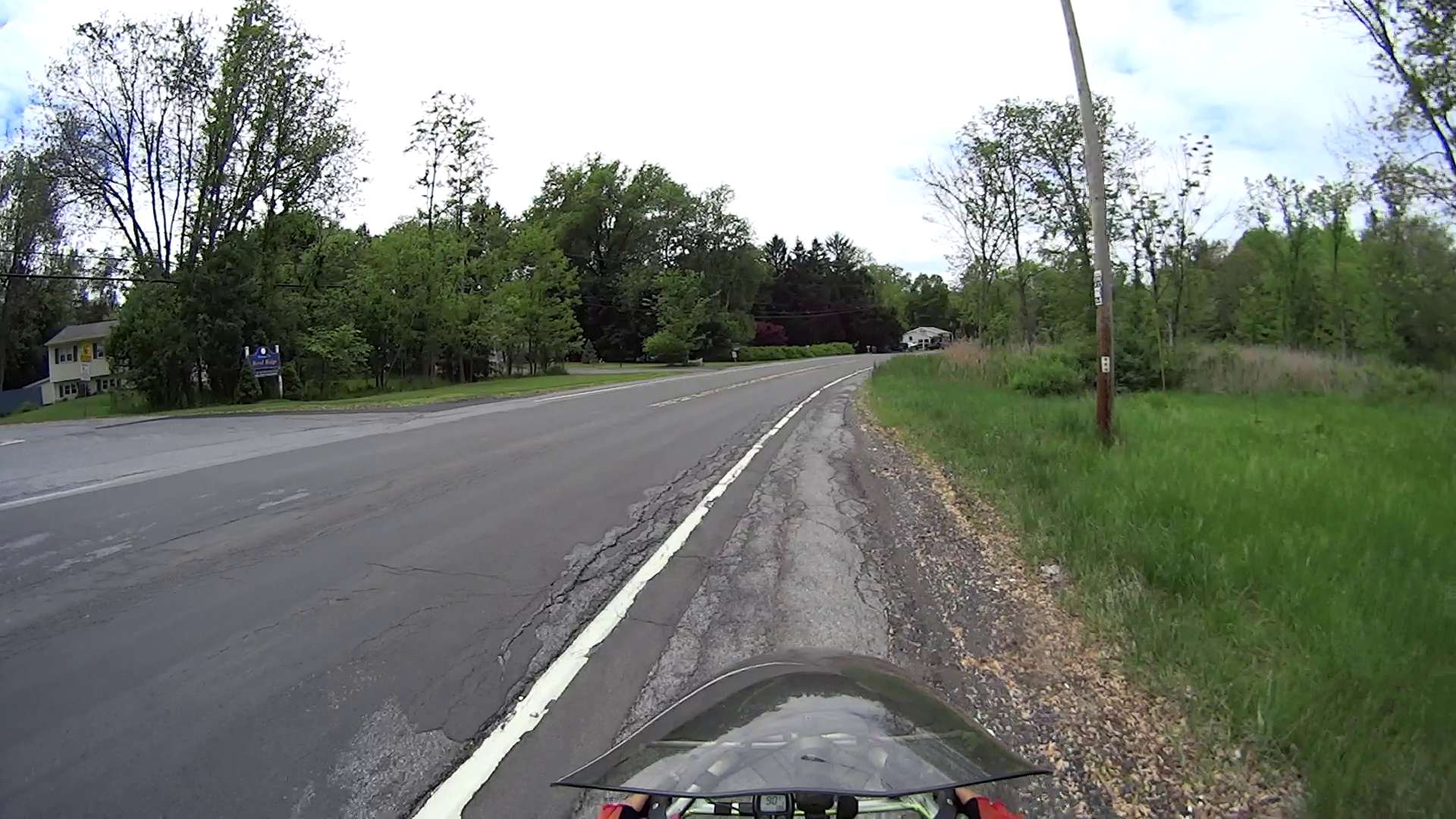
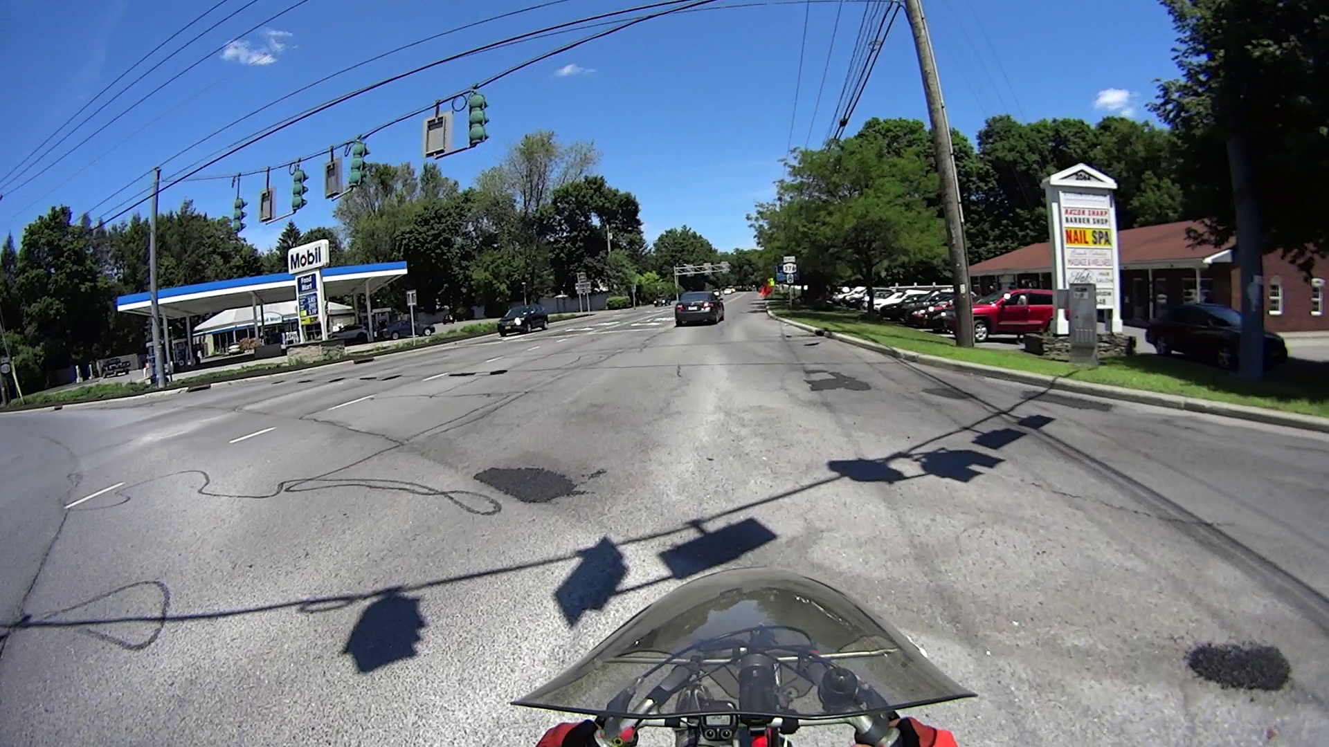
Entering Rt 376 from Diddell Road after leaving the Dutchess Rail Trail:
Rt 376 – Diddell to New Hackensack – 1
All of Rt 376 has thick gravel along the shoulder from the deteriorating asphalt.
The wheel-trapping longitudinal cracks on the shoulder show where the previous surface extended beyond the bottom paving layer. Basically, you must ride to the right of the edge of the “new” cap over the travel lane and left of the parallel cracks:
Rt 376 – Diddell to New Hackensack – 2
Sometimes, you must use the road surface. Fortunately, it’s not too bad at this spot:
Rt 376 – Diddell to New Hackensack – 3
But it quickly returns to normal:
Rt 376 – Diddell to New Hackensack – 4
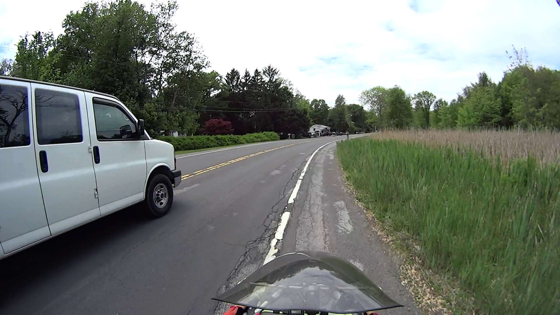
In some places, the travel lane is developing longitudinal cracks, so moving off the shoulder will require taking the lane:
Rt 376 – Diddell to New Hackensack – 5
Chooosing your line requires the ability to ride precisely between gravel, cracks, and traffic:
Rt 376 – Diddell to New Hackensack – 6
I can ride along this plateau every time, but it seems unreasonable to expect that level of ability from every bicyclist:
Rt 376 – Diddell to New Hackensack – 7
In this spot, the potholes expose three layers of paving. The only “safe” line seems to be on the very edge of the “new” cap, just to the right of the potholes:
Rt 376 – Diddell to New Hackensack – 8
The “new” cap didn’t adhere to the previous asphalt very well, perhaps because the thickness dropped below the spec. I’m crossing the travel lane to reach the left turn storage lane at the New Hackensack signal, having avoided a drain grate that occupies the ever-narrowing shoulder:
Rt 376 – Diddell to New Hackensack – 9
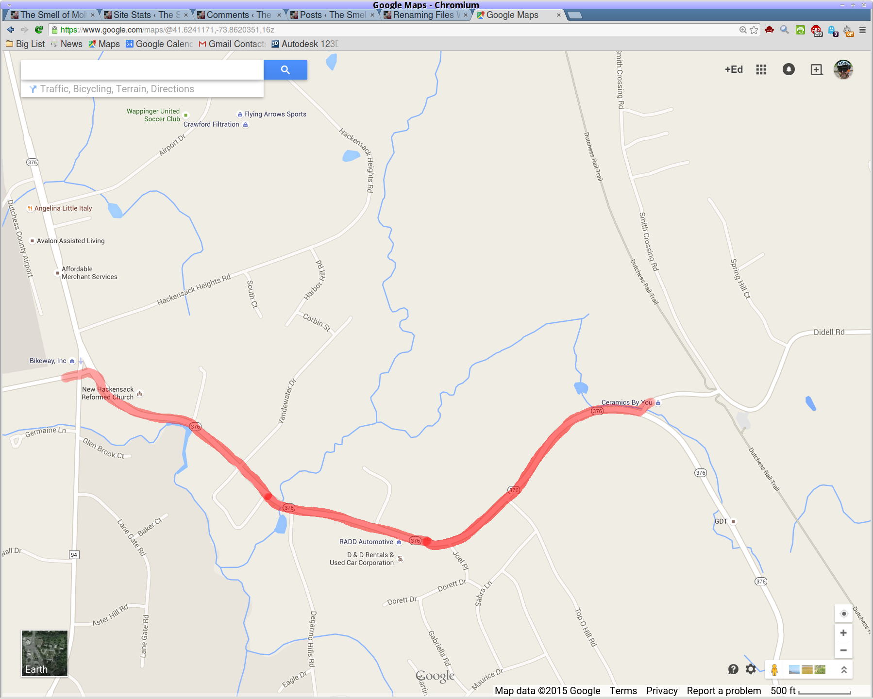
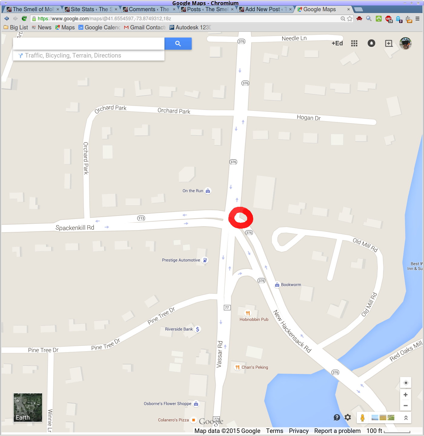
A map showing the route:
Rt 376 – Diddell to New Hackensack – map
[Edit: A comment from someone who shall remain anonymous:
This person has found an amusing way to get attention to potholes: he just adds a penis drawing to the pothole with spray paint.